Lost in Busan's Night Maze, Saved by NAVER
Lost in Busan's Night Maze, Saved by NAVER
The neon glare of Jagalchi Market blurred into watery streaks as I frantically wiped rain from my phone screen. My friend Min-jun's birthday dinner reservation ticked away in 15 minutes, yet we circled the same squid stall for the third time. "Traditional alley restaurant" my foot – this felt like a cruel treasure hunt where the prize was cold soup and shame. Thrusting my dying phone toward damp alley walls, I triggered NAVER Map's AR mode as a final prayer. Suddenly, floating arrows materialized on the cracked pavement like digital breadcrumbs, cutting through the visual chaos of hanging octopi and steaming kimbap stalls.
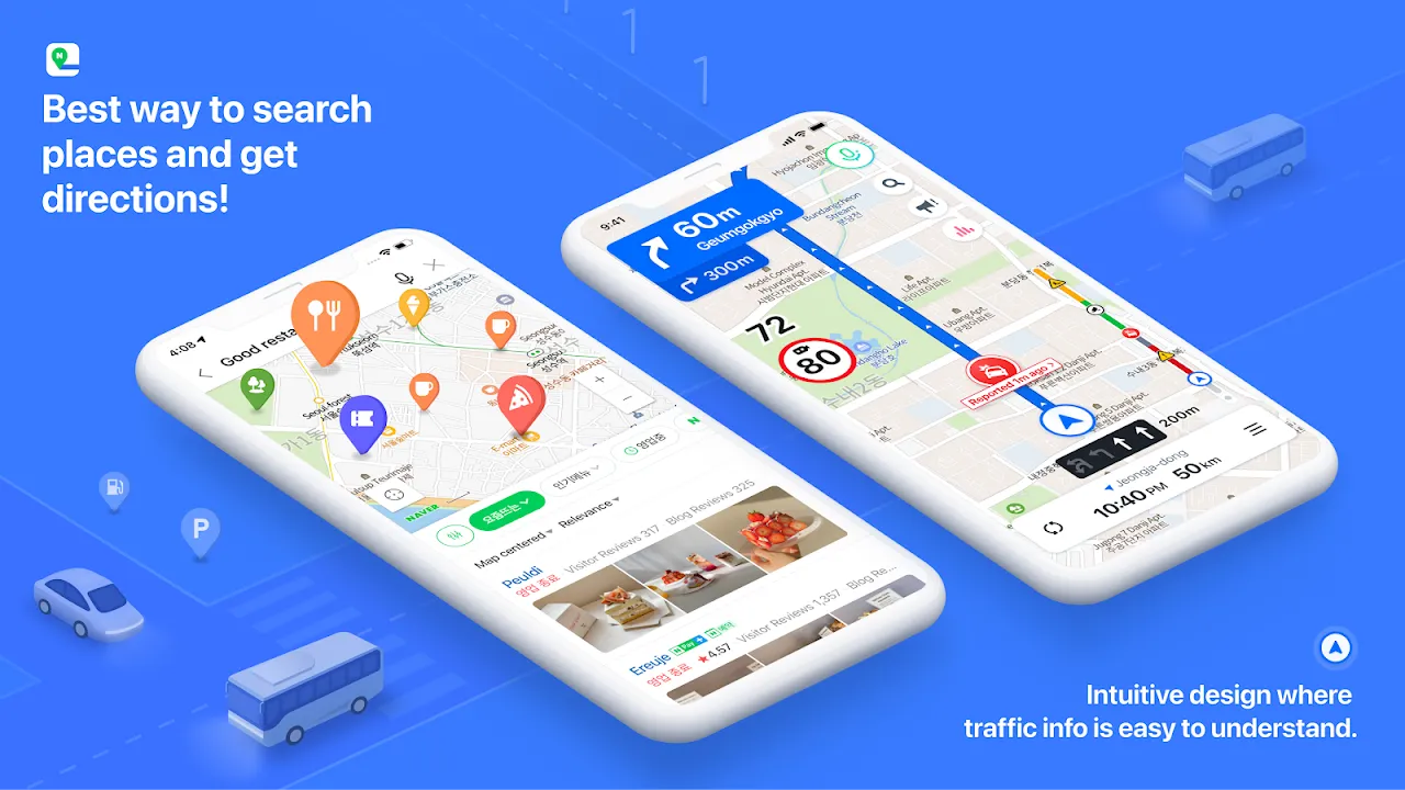
That glowing path felt like cheating reality. Traditional GPS had failed us spectacularly – the blue dot jumped between buildings like a drunken firefly thanks to the canyon effect of packed market stalls. But this augmented view ignored the vertical chaos, painting directions directly onto the physical world. I marveled at how the simultaneous localization and mapping algorithms anchored virtual arrows to crumbling brickwork, unaffected by the canopy of tarps above us. When Min-jun grabbed my arm shouting "There! The blue lantern!", I nearly dropped the phone in disbelief. The AR overlay highlighted the restaurant's entrance we'd passed twice, camouflaged between a fish gutting station and a soju vendor.
Our victory hug was cut short by the app's sudden crash. The price for our salvation? My battery plummeted from 30% to 3% in eight minutes flat. NAVER's navigation might be witchcraft, but it burns through power like a bitcoin miner. We scrambled toward the charging station inside, laughing at the absurdity of being simultaneously rescued and betrayed by the same technology. That moment crystallized my relationship with this digital guide – brilliant yet demanding, like a genius friend who always needs a favor afterward.
Later, analyzing our near-disaster, I discovered NAVER's secret weapon against urban canyons: its proprietary 3D mapping database that weights Wi-Fi signals and cell tower triangulation differently based on building density. Unlike Google's satellite-dependent approach, NAVER pre-loads structural data to predict signal bounce. This explained why the blue dot stabilized once we moved toward wider alleys, the app intuitively shifting positioning strategies. Yet for all its intelligence, it still couldn't solve the eternal mystery of Korean addresses – that restaurant was technically in "Alley 5-2-1-ga", a designation known only to local ghosts and NAVER's servers.
Weeks later, I tested the app's limits during a downpour in Gamcheon Culture Village. Waterfall-stairs became death traps as my umbrella inverted. Voice navigation garbled into static soup, but NAVER anticipated this – vibrations pulsed distinct patterns through my phone: two buzzes for left, three for right. This haptic feedback system transformed my pocket into a tactile compass. Yet when I finally reached the observatory, the app proudly declared "You have arrived!" while facing a concrete wall. The actual entrance? Thirty meters downhill behind a mural of flying fish. Perfection remains elusive, it seems.
Now I wield NAVER Map like a seasoned duelist – AR mode for market labyrinths, offline maps for subway dead zones, vibration alerts for monsoon days. But I've learned its cruel irony: the more brilliantly it performs, the faster your battery screams for mercy. Still, when dusk stains Busan's hills purple and alleyways dissolve into shadow, I tap that yellow icon with pilgrim's faith. Just never without a power bank.
Keywords:NAVER Map,news,augmented reality navigation,urban GPS challenges,battery drain issues


