Fogbound on Hardangervidda: How a Map App Saved My Skin
Fogbound on Hardangervidda: How a Map App Saved My Skin
My fingers had turned into clumsy icicles inside damp gloves when I first realized I couldn't recognize a single rock formation through the thickening mist. That familiar cocktail of panic and stupidity flooded my veins - why had I ignored the storm warnings for this solo hike across Norway's highest plateau? As horizontal sleet needled my face, I fumbled with my phone through three layers of clothing, silently cursing the "offline maps" I'd downloaded that morning. When the topographic display finally flickered to life, showing my pulsing blue dot precisely where I'd feared - 300 meters from a sheer drop - I actually kissed the cracked screen. Those crisp elevation lines weren't just data; they were braille instructions from the mountain itself.
The moment digital lines became lifelines
What astonished me wasn't just the GPS accuracy in that whiteout, but how the app visualized the land's skeleton beneath the snow. Those brown contour intervals tightened like fingerprint whorls where cliffs hid in the fog, while wider spacing revealed safe passage. I learned to "read" the terrain through my numb thumbs - tracing virtual ridgelines with one hand while gripping ice-encrusted basalt with the other. When I finally stumbled into a emergency hut hours later, steam rising from my parka like a locomotive, I realized I'd been navigating using glacial hydrology symbols without consciously registering them. The map had bypassed my frozen brain and spoken directly to muscle memory.
This topographic wizardry operates through vector-based rendering that consumes less data than a single Instagram photo. Unlike those candy-colored navigation apps that crumble without signal, this one stores entire mountain ranges in compressed packets smaller than your average podcast episode. I'd downloaded the Hardangervidda sector over lukewarm airport coffee, never imagining that 47MB file would become more vital than oxygen.
Urban jungle? More like fjord labyrinth
Months later in Stavanger's rain-lashed harbor district, I chuckled at tourists huddling under awnings with paper maps dissolving into pulp. Tapping my screen revealed hidden staircases between clapboard houses, their elevation shifts marked with subtle gradient shading that warned of calf-burning climbs. When hunting for a specific vintage shop, the building footprints mode identified structural oddities - like how shop 14B was actually accessed through a 19th-century courtyard invisible from the street. The app didn't just show streets; it exposed the city's anatomical layers like a digital archaeologist.
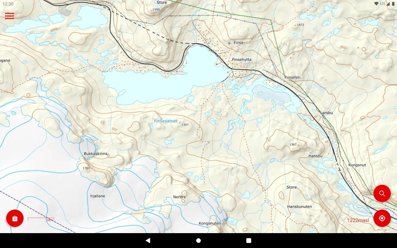
Yet it's not flawless. During a midnight aurora chase near Finse, the battery drain hit like a sucker punch - 30% vanished in 45 minutes as the GPS fought blizzard interference. I now pack three power banks religiously. And the interface? Let's just say its aesthetic charm lies somewhere between a 2005 Nokia and Soviet industrial design. But when you're deciphering avalanche paths on Jostedalsbreen, you'll trade pretty icons for glacier-tuned precision every damn time.
When paper maps betray you
I learned this brutally near Trolltunga last summer. My cherished waterproof topo map - the one I'd marked with confident highlighter strokes - showed a gentle valley ascent. The app revealed reality: a contour line swarm indicating near-vertical scree where the "trail" disappeared. As I watched two hikers ahead skid dangerously, their paper flapping uselessly in the wind, I detoured using real-time slope analysis. Later, comparing versions, I discovered my physical map was revised in 2003 - before massive rockslides reshaped the terrain. That's the killer feature: constant updates from Norway's mapping authority, where even seasonal footpath erosion gets logged before most hikers notice.
Now when I hike, I still carry paper as backup. But my eyes constantly dart to the phone, watching elevation numbers tick upward like a personal altimeter. There's primal satisfaction in cresting a pass and seeing the map's perspective flip - watching fjords unfold in digital miniature exactly as they do before my wind-burned eyes. It's made me bolder in explorations yet paradoxically more humble; technology shows me precisely how small I am against ancient geology. Last week, deep in Rondane National Park, I found myself talking to the app like a climbing partner: "See that pass? Looks brutal but the contour intervals suggest..." before realizing no other soul was within 20 miles. Maybe that's the ultimate testament - when a navigation tool becomes your most trusted trail companion.
Keywords:Norgeskart,news,offline navigation,topographic maps,wilderness safety


