Frozen Coordinates, Beating Heart
Frozen Coordinates, Beating Heart
Wind screamed like a wounded animal through the Gore Range canyon, stealing the warmth from my bones with each vicious gust. Snowflakes weren't falling anymore; they were horizontal bullets stinging my exposed cheeks. My fingers, clumsy in thick gloves, fumbled with the laminated map as another blast nearly tore it from my grasp. The printed UTM coordinates mocked me - 13S 415823mE 4391276mN - meaningless hieroglyphs against the whiteout swallowing Colorado's backcountry. Panic, cold and metallic, flooded my mouth. My primary GPS had died an hour ago, its screen fading like my hopes. In that moment of crystalline despair, I remembered the forgotten app buried in my phone's utilities folder.
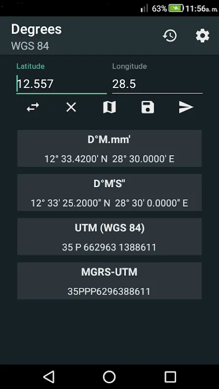
Shielding the screen with my body, I stabbed at the icon with a numb thumb. What greeted me wasn't some glossy interface, but a beautifully sparse grid - empty fields hungry for numbers. I punched in the UTM figures from the map, my breath fogging the glass. Then came the magic dropdown: WGS84 Decimal Degrees. One tap. Instantly, new numbers appeared: 39.6421° N, 106.1417° W. Not just numbers - a language my phone's native maps understood. That precise translation felt like someone shouting coordinates into the void of the storm. Relief washed over me, warmer than any campfire. This wasn't just data; it was a lifeline etched in digital ink.
The real sorcery unfolded as I started moving. With each slippery step through knee-deep powder, the app's elevation tracker documented my crawl. 3,112 meters... 3,119... 3,125. Seeing those incremental climbs validated the burn in my thighs - a cruel but honest companion. Later, I'd learn how it fused barometer readings with GNSS satellite data, but in that moment, it simply *felt* like the mountains whispering their secrets directly into my glove. When I finally spotted the emergency shelter's roof through the blizzard, the elevation readout blinked at 3,278 meters - matching the map's promise exactly. I nearly wept into my frozen buff.
But let's not romanticize the beast. That constant location polling? It devoured my battery like a starved wolverine. Down to 12% after just ninety minutes in the cold - a heart-stopping moment when the screen flickered ominously. And that "intuitive" offline topo overlay? More like a drunken cartographer's sketch. The app rendered contour lines beautifully... until it didn't, smearing critical ridges into vague green blobs just as I needed precision most. I cursed its name to the howling wind, questioning why any developer would prioritize pretty gradients over functional clarity when lives literally hang in the balance.
Hours later, thawing by a hissing propane heater, I studied the app's coordinate history like battle scars. Each plotted point told a story of terror and triumph - the frantic zigzag when I overshot a col, the steady climb up the couloir, the final triumphant dot atop the pass. This digital breadcrumb trail wasn't just data; it was the biometric signature of survival. I finally understood what made this tool different: it didn't just show me where I was. It showed me *how* I got there - the elevation gained, the coordinate systems bridged, the very architecture of my escape laid bare in mathematical poetry. That night, as wind still clawed at the cabin walls, I slept not just with gratitude, but with the profound, hard-won intimacy that comes from truly speaking a mountain's language.
Keywords:Coordinate Converter Plus,news,GPS wilderness survival,topographic mapping,altitude navigation


