Mountain Pass Panic: My RV App Lifeline
Mountain Pass Panic: My RV App Lifeline
Rain hammered the windshield like thrown gravel as my 35-foot diesel pusher crawled up Colorado's Independence Pass. Each switchback felt like a dare against gravity—guardrails mere inches from tires grinding on crumbling asphalt. My knuckles whitened around the steering wheel; the onboard GPS had gone rogue five miles back, cheerfully routing me toward a 10-foot clearance underpass that would've sheared my roof off. In that claustrophobic cab, smelling of wet dog and diesel fumes, I fumbled for my phone with grease-slick fingers. Regular navigation apps were reckless gamblers with my home-on-wheels. Then I tapped the RV LIFE icon.
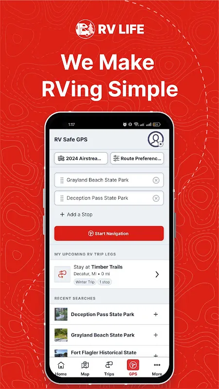
The map loaded with a low chime—a sound I'd later equate with survival. Unlike generic apps, this demanded specifics upfront when I set it up months prior: exact height (13'2"), length, even propane tank locations. Now those details became armor. Crimson warnings blazed across the screen: ROAD GRADE 14%—MAX 8% FOR YOUR RIG. Below, an alternate route unfurled in calm blue, snaking toward a valley campground with pull-through sites. The relief hit like a gulp of hot coffee. Voice navigation didn't just say "turn left"; it rasped, "In 800 feet, make wide left turn—shoulder drop-off confirmed." That granularity wasn't code—it was curation by thousands of rigs that blazed these trails before me.
Descending into Glenwood Canyon, sleet blurred the world into gray sludge. RV LIFE’s proprietary algorithm—fueled by DOT databases and real-time user reports—flagged black ice patches ahead. But the magic lived in its campsite integration. Tapping "emergency stops," it filtered not just by distance, but by live electrical hookup status and propane-filling stations. One tap reserved Spot #12 at Riversong Ranch, whose reviews warned of "low branches near dump station—avoid with tall rigs." When my generator sputtered minutes later, those 50-amp outlets became lifelines. I learned later the app cross-references weather APIs to prioritize sheltered sites during storms—a layer of foresight that kept my slide-outs deployable.
Criticism bites, though. Two weeks later in Utah’s desert, the app froze mid-route—cell towers as scarce as shade. For twenty agonizing minutes, I white-knuckled through sandstone canyons praying for signal. When it rebooted, rerouting around a washed-out bridge, the delay nearly cost me daylight. Still, its offline maps saved the trip; downloaded regions loaded campsite prices even without bars. That hiccup couldn’t erase how it spotted a low-hanging power line in Moab that Google Maps ignored—a silent killer my AC unit would’ve snagged.
Now, planning a route feels like consulting a grizzled trail boss. The app’s weight-based bridge restrictions feature once rerouted me from a rusty Montana overpass rated for passenger cars only. Yet beyond tech, it’s the community pulse—real photos of tight squeezes into Yosemite sites, warnings about aggressive raccoons at Oregon Coast KOAs. Last Tuesday, it pinged me about a last-minute cancellation at a Wyoming ranch with hot springs. I arrived to steam rising into pine-scented dusk, my tires crunching gravel the app promised was "level enough for jacks." That’s not data—it’s deliverance.
Keywords:RV LIFE,news,RV navigation,campground finder,road safety


