My Desert Rescue: GPS Saved Me
My Desert Rescue: GPS Saved Me
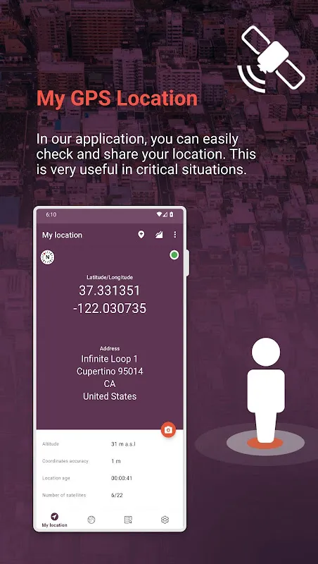
I never thought a simple hiking trip in the Mojave Desert would turn into a heart-pounding test of survival. The sun was dipping below the horizon, casting long shadows that distorted the familiar sand dunes into alien landscapes. My throat was parched, and each step felt heavier as doubt crept in—had I taken a wrong turn? Panic started to set in when I realized my printed map was useless in the fading light, and my phone battery was at a critical 15%. That's when I fumbled for my device, fingers trembling, and opened the location app I'd downloaded on a whim weeks earlier. The immediate ping of my exact coordinates, accurate to within meters thanks to its multi-frequency GPS technology, felt like a lifeline thrown into choppy waters. It wasn't just dots on a screen; it was my way home, and the relief washed over me in a wave that left me breathless with gratitude.
As I navigated back using the app's offline maps—a feature I'd scoffed at initially but now praised silently—I marveled at how it leveraged GLONASS and Galileo satellites alongside standard GPS to maintain precision even in remote areas. The interface was intuitive, with breadcrumb trails that showed my path and estimated time to destination based on my walking pace. But it wasn't perfect; at one point, the app struggled with a brief signal dropout in a canyon, causing a spike of anxiety until it recalibrated using cell tower triangulation as a backup. That moment of vulnerability made me curse the tech's limitations, yet it also highlighted the robustness of its design. I found myself whispering thanks to the developers for incorporating battery-saving modes that dimmed the screen and reduced background processes, stretching those precious percentage points into a full hour of guidance.
The emotional rollercoaster didn't end there. With each step guided by the app's voice prompts—calm and reassuring—I reflected on how this tool had transformed from a mere utility into a companion. It captured not just my location but the essence of the journey: the crunch of sand underfoot, the cool evening breeze that carried scents of sagebrush, and the gradual return of confidence as I spotted landmarks aligned with the app's data. I even used its geotagging feature to mark a beautiful rock formation I'd stumbled upon, vowing to return with better preparation. This experience underscored how technology, when woven seamlessly into life's raw moments, can elevate adventure rather than detract from it.
Back at my car, as I gulped water and let the adrenaline fade, I couldn't help but feel a mix of awe and criticism. The app had excelled in precision and reliability, but its initial setup had been clunky, requiring permissions that felt invasive until I understood their necessity for accurate tracking. Still, the joy of safe return overshadowed any minor gripes. This wasn't just an app; it was a testament to human ingenuity, blending satellite science with user-centric design to turn potential disaster into a story of triumph. I drove off with a renewed respect for how digital navigation tools empower explorers to push boundaries while staying grounded in safety.
Keywords:My GPS Location,news,desert survival,satellite technology,outdoor navigation


