Radar in My Pocket
Radar in My Pocket
Salt stung my eyes as I squinted at the horizon, kayak bobbing like a cork in suddenly choppy water. My weather app's cheerful sun icon mocked me—no mention of the bruise-purple clouds devouring the coastline. Panic fizzed in my throat. I’d been fooled by smooth forecasts before, once scrambling ashore seconds before lightning split a dock I’d just vacated. Weather apps felt like polite liars, their animations pretty but useless when the sky turned violent.
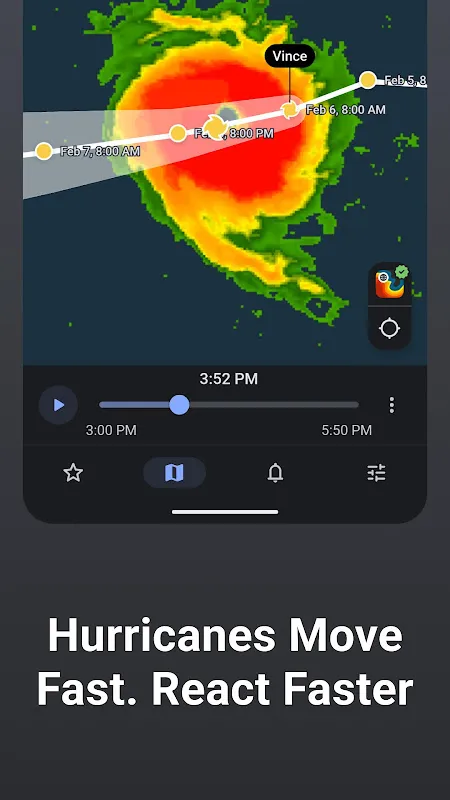
Fumbling my phone inside its waterproof case, desperation led me to RainViewer. Installed weeks ago and forgotten. What opened wasn’t cartoon clouds or vague percentage chances. It was raw, pulsing NEXRAD radar—a live, unfiltered feed painting the atmosphere’s rage in swirling greens and reds right over my GPS dot. No interpretation, just the storm’s naked truth. A thick crimson band, heavy with rain and likely hail, was 12 minutes out. Directly between me and the marina.
The Sky UnzippedI paddled hard, muscles burning, eyes glued to the screen. RainViewer didn’t just show the storm; it revealed its guts. I watched the leading edge of that crimson band intensify, seeing the velocity data indicating rotation—not tornado-level, but enough for nasty wind shear. Standard apps would have said "70% chance of rain." This showed the storm’s teeth. The hyperlocal alert vibrated my phone precisely 8 minutes later: "Heavy precipitation arriving in 4 minutes." I counted seconds as I hauled the kayak onto the rocky beach. The first cold, fat drops hit as I secured the last strap. The sky unzipped. Torrential rain, dime-sized hail, and wind that would have flipped me in open water hammered down. I stood soaked and shaking under a boathouse awning, watching chaos through rain-streaked glass, utterly reliant on the radar image still updating on my screen—a technicolor lifeline.
This wasn’t prediction; it was revelation. RainViewer bypasses the sanitized, averaged models. It taps directly into the same Doppler radar feeds meteorologists use, processed with minimal smoothing. You see the actual precipitation density, wind direction within the storm cells, even estimates of hail size based on dual-polarization technology. It feels less like checking an app and more like plugging your phone into the atmosphere’s nervous system. The cost? Steep learning curve. Interpreting raw radar is an art. That crimson blob could mean a downpour or a derecho. You learn to read the textures—the sharp hooks indicating rotation, the fine speckles of drizzle versus the solid blocks of torrential rain. It demands engagement, turning weather tracking from passive consumption into active interpretation.
Not Just Knowing, But SeeingIt changed my relationship with the sky. Planning a bike ride? I don’t glance at icons; I study the radar loop’s movement, seeing if that patchy green over the hills is drifting east or dissolving. Grilling dinner? A quick zoom on the live map shows if the faint echoes near the county line are strengthening or fizzling. I curse it sometimes—its brutal honesty ruining picnic plans with undeniable evidence of an approaching deluge. But that honesty forged trust. When it shows clear, I believe it. When it shows red bearing down, I move. The power isn't just in knowing *if* it will rain, but *exactly when and how hard* it will hit my backyard. That precision, ripped straight from the radar dome, turns dread into decisive action. My phone isn’t a weather app anymore. It’s a window into the storm’s furious heart.
Keywords:RainViewer,news,storm tracking,radar technology,weather precision


