Signal Lost, Campsite Found
Signal Lost, Campsite Found
The Sierra Nevadas swallowed my cell signal whole that twilight hour. One moment I’d been replaying a podcast about black bear encounters; the next, silence. True silence – the kind where your ears ring and your knuckles whiten on the steering wheel. My RV’s headlights carved tunnels through pine shadows as the dashboard clock screamed 7:48 PM. Sunset in twelve minutes. Every dirt pull-off I’d passed for miles screamed "private property" or "no overnight stays," and my tank sat at 1/8 full. Panic tasted like copper pennies when I slammed the brakes near a washed-out sign, fumbling for my phone with hands shaking hard enough to blur the screen.
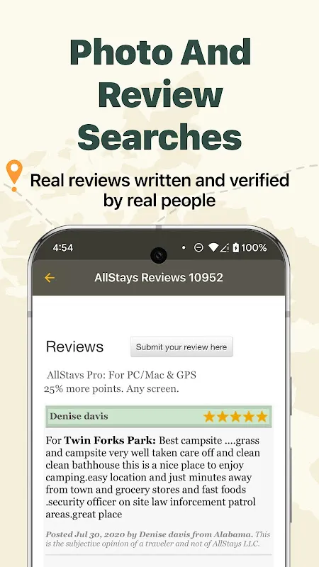
That’s when muscle memory kicked in – three thumb-swipes to the second homescreen, past the useless weather apps begging for bars. The tent icon glowed back at me: AllStays Camp & RV. I’d downloaded it as an afterthought during a gas station Wi-Fi binge three states back. Now its offline database became my lifeline. No spinning wheels, no "searching..." ghosts. Just instant blue dots blooming across a vector map while my GPS chip – indifferent to dead zones – anchored me as a pulsing red arrow. The real witchcraft? Filtering for "RV accessible NOW" while my battery hemorrhaged 12% per minute. It spat back seven options within 15 miles. Seven chances to not sleep roadside praying bears couldn’t smell terror.
When Pixels Beat Paper Maps
Most navigation apps crumble without cloud servers, but this thing ran on pure device-stored topology. I watched in real-time as it rendered terrain contours using elevation data baked into its core – no streaming needed. Tapping a campsite revealed not just coordinates but granular details: "Max RV length: 32 ft" (I was 28), "Water spigot: seasonal" (still flowing per April update), even "Host named Betty – complains if generators run past 8 PM." All cached during that last Wi-Fi hit. When I selected "Pinecrest Grove," it overlaid my route with purple elevation gradients. That steep 8% grade ahead? The app knew my ’99 Fleetwood’s transmission would overheat halfway up and rerouted me through a longer but flatter fire road. Pure algorithmic mercy.
The Beautifully Clunky Lifeline
Let’s gut the hero narrative: this digital compass has the aesthetic charm of a 2005 Garmin. Pinch-zooming stuttered like a dial-up modem. Scrolling through amenities made my thumb ache. But when twilight bled into proper dark and my headlights caught the reflective "PINE CREST" sign exactly where the map promised? I forgave every pixelated tree icon. The real magic happened at check-in. Betty emerged squinting with a flashlight as I killed the engine. "How’d you find us?" she rasped, "Website’s been down since the storm." I showed her my screen – her little dot glowing steadfast beside my red arrow. She cackled. "That old app? Figured everyone used those fancy cloud things now." Her dentures clicked approvingly. "Smart. Clouds die. Mountains don’t."
Dawn revealed what desperation hid: potholes deep enough to swallow tires, branches clawing my roof. The app hadn’t sugarcoated it – its "road condition: poor" warning flashed pre-entry. I’d ignored it, drunk on the promise of flat ground. But here’s the raw truth: I’d take Betty’s lumpy gravel over Verizon’s false "full bars" any wilderness evening. Later, over bitter camp coffee, I dissected why it worked when others vaporize offline. Unlike streaming-dependent apps, AllStays treats your phone like a standalone GPS unit – storing map tiles locally and accessing satellites directly. No middleman servers to fail. The trade-off? A 1.2GB download that made my phone groan. Worth every megabyte when you’re reading "NO SERVICE" where your navigation app should be.
Would I romanticize it? Hell no. Searching for "dog-friendly" sites later, I cursed the dropdown menus that felt coded by DOS enthusiasts. And discovering Betty’s "quiet hours" actually meant "no breathing loudly" after 7 PM? The app’s crowd-sourced reviews undersold her militaristic shushing. But as I sipped coffee watching mist rise from valley firs, a bald eagle circling overhead like some cliché postcard, the grudging respect solidified. This wasn’t some slick Silicon Valley darling. It was a digital Swiss Army knife – scratched, stubborn, and spectacularly unbreakable when everything else fails. My phone finally died as I took the photo. Perfect. Some moments shouldn’t be filtered through apps anyway.
Keywords:AllStays Camp & RV,news,offline navigation, wilderness camping, RV travel


