Squall Lines and Digital Lifelines
Squall Lines and Digital Lifelines
The Pacific doesn't negotiate. I learned that halfway between Fiji and Vanuatu when my barometer started plunging like a stone. My hands trembled as I unfolded water-stained charts - ancient relics suddenly laughable against the purple-black horizon devouring daylight. Radio crackled with panicked French from a cargo ship somewhere in the murk. That's when I remembered the strange icon on my tablet: qtVlm.
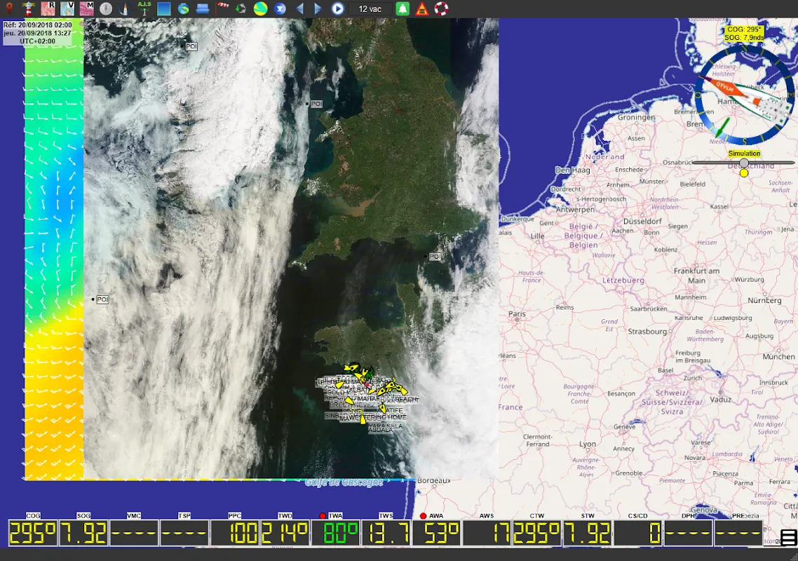
Fumbling with salt-crusted fingers, I fired up the app just as the first horizontal rain lashed the cockpit. What unfolded felt like black magic. Suddenly, abstract danger had structure: crimson wind barbs marching toward me, isobars coiled like venomous snakes. But more crucially, live wind and current data revealed a narrow escape corridor invisible to human senses - a sliver of manageable 25-knot winds just 8 miles northwest. I altered course through stinging spray, heart hammering against my ribs.
What followed wasn't just navigation; it was a high-stakes dance with atmospheric algorithms. The genius lies in how qtVlm digests raw meteorological chaos. It ingests massive GRIB files - those unassuming digital containers holding worldwide weather forecasts - then layers them over NOAA charts with terrifying precision. While I white-knuckled the helm, its engine crunched vectors and pressure gradients, calculating how my 40-foot sloop's polar performance curves would interact with building swells. Dynamic tidal compensation adjusted my track every 90 seconds as currents shifted beneath me.
By midnight, I was surfing 15-foot following seas in manageable conditions while the main fury passed 20 miles south. Moonlight glinted off the tablet where route optimization algorithms charted our path like a celestial highway. The real witchcraft? How it transformed satellite wind observations into tangible strategy - showing exactly when to reef before gusts hit, where to find favorable current conveyor belts, how to angle attacks on waves. This wasn't some sterile GPS plotter; it felt like having a meteorologist, tactician, and old salt whispering in my ear simultaneously.
Critique claws through even awe though. That salvation came with infuriating trade-offs. The interface looks like 2003 called demanding its DOS aesthetics back - nested menus within cryptic icons buried under visual clutter. During critical maneuvers, I nearly pitched overboard trying to toggle between wind barbs and wave height overlays. And dear gods, the learning curve. It took three near-groundings before I understood why the app kept screaming about georeferenced chart offsets. This brilliance demands blood sacrifice in usability.
Yet when dawn broke on calm turquoise waters, my resentment evaporated. There's primal terror in being a speck in liquid mountains, then profound relief when technology turns the ocean's wrath into navigable mathematics. qtVlm didn't just show me a path - it revealed the hidden architecture of the sea itself. My paper charts now make excellent cocktail coasters.
Keywords:qtVlm,news,live weather routing,offshore navigation,sailing technology


