Typhoon Transit: When Pixels Outperformed Paper
Typhoon Transit: When Pixels Outperformed Paper
Rain lashed against the train windows like gravel thrown by a furious child. Outside, Shizuoka Station dissolved into a watercolor nightmare of blurred neon and slick concrete. My cheap umbrella lay mangled in a bin three towns back, victim to a sudden gust that nearly sent me tumbling onto the tracks. Inside, chaos reigned. Delayed announcements crackled through distorted speakers in rapid-fire Japanese, their meaning as opaque to me as the kanji swimming on every sign. Families huddled, salarymen sighed, tourists like me stared blankly at disintegrating paper timetables, ink bleeding into soggy pulp. Panic, cold and metallic, started coating my tongue. My meticulously planned day trip to see Fuji-san? Washed away, along with my sense of direction.
I fumbled for my phone, fingers trembling and slick. The screen protested under the dampness, refusing to register my frantic swipes. Offline routing database. That phrase flashed into my mind, a desperate anchor. Weeks earlier, preparing for this trip, I’d downloaded Japan Transit Planner precisely for this horror scenario – no signal, no hope. Back then, the act felt like overkill, a digital security blanket. Now, it was my only lifeline. Tapping the icon felt like cracking open an emergency flare.
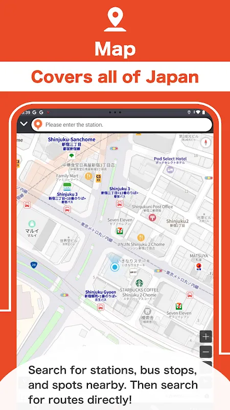
The app loaded, blessedly indifferent to the storm raging outside and the network blackout within. Its interface was stark, functional – no cherry blossoms, no cute mascots, just grids and numbers. I stabbed at my current location: Shizuoka Station. My destination: the ryokan back in Mishima, miles away. My pulse hammered against my ribs. Could it really find a way through this mess without live data? The processing spinner felt agonizingly slow. Then, it appeared: a stark white route against a dark blue background. Not one option, but three, each factoring in the typhoon-induced delays the app had somehow cached before the networks died.
Platform-Level Precision in a Downpour
It wasn’t just "Take train X to station Y." It was: "Walk 80m to Platform 3 (South End)." "Board Limited Express Fujikawa 15 (Delayed 27 mins) departing 18:03." "Alight at Platform 1, Numazu Station. Transfer window: 4 minutes." "Ascend stairs, turn left, proceed 120m to Bus Bay C." "Board Mishima Line Local Bus #42 departing 18:47." Each instruction was a cold, hard fact punched through the fog of my anxiety. The real-time disruption algorithms, working off that pre-loaded data, weren't guessing; they were recalculating the possible amidst the impossible. It even warned of a likely 8-minute additional delay on the bus due to flooding near route marker 17. This wasn't guidance; it was a tactical briefing for urban survival.
Executing the plan was an exercise in focused terror. Platform 3 was a maelstrom of wind and spray. Finding the "South End" meant battling sideways rain, the app’s little blue dot on the station map my only true north. The train, when it finally groaned in, was packed, humid, smelling of wet wool and exhaustion. I clutched my phone like a talisman, watching the animated progress bar inch along the route, the estimated arrival time at Numazu flickering as the train crawled. Four minutes to transfer. Four minutes! Disembarking into the chaotic scrum of Numazu’s platform 1, the app didn’t just say "Bus Bay C." It showed a schematic: "Exit train, turn immediately right, ascend staircase B (40 steps). Top of stairs, immediate left, proceed past kiosk. Bay C: 50m ahead on right." I ran, dodging commuters, following the digital breadcrumbs. The bus driver was already closing the doors when I skidded to a halt, gasping, at Bay C. He saw my dripping, desperate face, glanced at his watch, and sighed, waving me aboard with a grunt. The doors hissed shut behind me. Four minutes. The app knew the walk time, the crowd density, the human pace required.
Sitting on that blessedly warm, dry bus, watching the storm rage outside the steamed-up windows, the relief wasn't just physical. It was profound. That crumpled paper map in my bag was more than useless; it was a symbol of my arrogant pre-digital confidence. Japan Transit Planner hadn’t just gotten me home; it had sliced through the paralyzing uncertainty with platform-specific certainty. It turned a potential travel nightmare – a night spent lost, cold, and broke – into a story I could tell over hot soba at the ryokan. Its genius wasn't in flashy features, but in its ruthless, offline-enabled efficiency. It didn't just plan transit; it engineered escape routes. And on that typhoon-lashed evening, it felt less like software and more like salvation.
Keywords:Japan Transit Planner,news,offline navigation,typhoon travel,Japan trains


